British Columbia, the most westerly province in Canada, faces the Pacific Ocean. The coastline is indented with hundreds of narrow, twisting inlets. Some of them reach inland as far as 60 miles. Vancouver Island and the Queen Charlotte Islands, which are part of British Columbia, lie between the coast and the open sea. The Inside Passage, a natural waterway that extends from Washington to Alaska, separates the islands from the mainland.
As a self-governing province, British Columbia, as claimed by many, is indeed a multicultural and heavenly landscape found in suburban Canada.
The Land

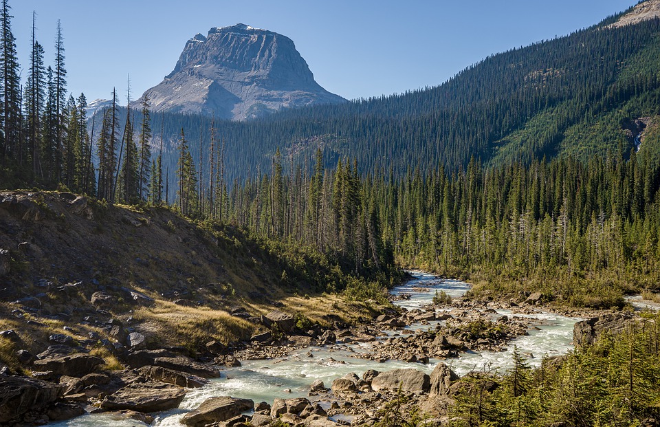
British Columbia is the most mountainous province in Canada. Row after row of jagged peaks must be crossed to travel from one side of the province to the other. In the northeast corner of the province are the forested, rolling plains of the Peace River district. Many rivers have cut narrow passes through the Rocky Mountains. Such passes as Crowsnest, Kicking Horse, Yellowhead and Pine are now used as road and railway routes across the Rockies.
The Coast Mountains form the western rim of British Columbia’s mainland. These forest-covered mountains rise steeply from the shores of the coastal inlets and the Inside Passage.
In the center of the province, lying at an elevation of 2,000 to 3, 000 feet, is an area of rolling tablelands and river valleys. This is the Interior Plateau. The towering mountains that encircle the plateau make it appear as a huge, oval basin, if it is seen from the air.
The Climate

British Columbia has a great variety of climates. In wi nter the climate along the coast is the mildest in Canada. Air masses moving eastward across the Pacific Ocean bring mild winters, cool summers and much rainfall to the coastal area. The average annual rainfall on western Vancouver Island of more than 100 inches is the heaviest in North America.
Summers are hotter and winters are colder in the interior of the province. There is much less rainfall than there is on the coast.
A Dive Back in History

In 1774, the Spanish voyager Juan Perez became the first European known to have reached the coast of British Columbia. Perez claimed the land for Spain. Four years later Captain James Cook arrived and claimed the land for Britain. For many years Spain and Britain contested the territory, but during these years both countries carried on a lively fur trade with the Indians.
In 1792 Captain George Vancouver explored Puget Sound and surveyed the coastal inlets. A year later Alexander Mackenzie, a trader with the North West Company, completed the first overland journey from eastern Canada to the Pacific coast. Finally Spain was forced to give up her claim and to recognize Britain’s right to the territory.
In 1808 Simon Fraser explored the river that now bears his name. By 1811 David Thompson had explored the southern interior and the Kootenay and Columbia rivers. During these years, the only European settlers were fur traders. Trading posts were established along the Columbia River and in the north. In 1843 Victoria on Vancouver Island became the center of the coastal fur trade. Settlers arrived and farming began.
In 1858 the discovery of gold in the Fraser River brought prospectors from eastern Canada and the United States. And, by 1861, the gold rush to the Cariboo Mountains was in full swing. Today, however, the most valuable minerals are copper, zinc, lead, asbestos, molybdenum, silver and tungsten.
It was not until 1871 that British Columbia became Canada’s sixth province. And, eventually, over the years, British Columbia has become ever more closely linked with the economic expansion of all of Canada.
So, if you are interested in British Columbia, why don’t you come back for part 2 where we shall reveal some of the best places of interest?